

Description
Overview
Denver is one of America’s fastest growing cities. But with this growth comes new challenges, such as managing the increase in traffic that is sure to follow. As part of its efforts to address this challenge, the Department of Transportation and Infrastructure (DOTI) is working to update the city’s public transit system – an effort that included inventorying the location and types of bus stop amenities. For this, they turned to All Traffic Data Services, LLC (ATD) and Felsburg Holt & Ullevig (FHU), who completed the task using the Trimble MX7 and ESRI’s ArcGIS platform.
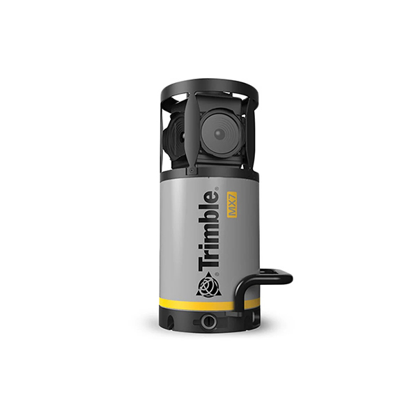
Utilize the Trimble MX7 to capture 360-degree, geo-referenced images at highway speeds to vastly reduce project operating cost whilst improving public safety. Then, use Trimble MX software to organize, visualize, interpret and efficiently extract structured data that can be integrated into a GIS and shared across your organization or via the Internet.
BACK AT THE OFFICE…
The collected data was downloaded and processed using POSPac MMS and Trimble Business Center software (TBC). POSPac MMS provides direct georeferencing of mobile mapping sensors, while TBC provides data management, visualization and computations. The georeferenced images were then uploaded to Mapillary, which was used as a simple platform for accessing and sharing the imagery. “Once in Mapillary, we used ArcGIS to capture an image of each bus stop,” says Boivin. “We then input the assets into a spreadsheet, which was later integrated into the final geodatabase provided to the client.” FHU, a multidisciplinary consulting firm with a focus on GIS services, played a critical role in developing this geodatabase. The company provided Denver with an attributed ESRI 10.x file geodatabase with detailed metadata that included capture dates, spatial extents and geospatial processes executed to populate the database.
“While the imagery captured by the Trimble MX7 was stored separately from the final bus stop amenity inventory geodatabase, it was beneficial to enable geodatabase file attachments and extract image snapshots from the MX7 imagery and physically embed them into the final geodatabase,” says Megan Ornelas, GIS Manager at FHU.
“This delivery method integrated seamlessly with Denver’s existing GIS infrastructure.”
DOTI is using this data to create a consistent base inventory of all bus stop amenities, identify deficiencies in the existing inventory and prioritize improvement projects.
ACCURACY, SPEED AND SAFETY
The DOTI project was ATD’s first experience using the Trimble MX7. However, due to its unprecedented accuracy, speed and safety, it won’t be its last. “Having precise location information made locating the stops much easier,” says Boivin. “It also proved valuable when it came time to add the images to the city’s GIS and asset management systems.” Using the MX7 also allowed for a huge time savings. “If we had to physically go to each stop and take a picture, the project would have taken up to 400 hours,” says Boivin.
“With the MX7, we collected the field data in just 100 hours.” Boivin also notes how the MX7 helps improve safety. Instead of using an off-speed vehicle that creates a traffic hazard, the MX7 allowed ATD to collect data while driving at the speed of traffic – a feature that made the process safer for everyone.