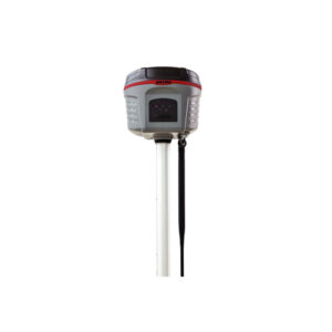
Integrated GNSS Systems-Trimble R2

The Trimble® R2 is a compact, durable GNSS receiver that provides an easy-to-use solution for GIS and survey professionals who need to collect highly accurate data in a wide range of geospatial applications. Capable of delivering between submeter and centimeter positioning accuracy in real-time to any mobile device via a wireless Bluetooth® connection, the R2 receiver gives you total flexibility to choose a solution based on the accuracy and GNSS performance level that suits your application, letting you work the way you want.

  • Professional solution for GIS & survey applications ranging from submeter to centimeter accuracies
  • Easily collect data by pairing with devices such as smartphones, tablets or Trimble handhelds
  • Fast to setup, easy-to-use, keeping you productive and focused on your work
  • Supports multiple satellite constellations and correction sources for accurate data at any location
  • Compact, cable-free design with integrated antenna
Request Inquiry

Description

High accuracy for survey & GIS applications

  • Capable of delivering submeter to centimeter level positioning accuracy in real-time to suit any field data collection application.
  • Achieve higher accuracy in real-time using correction sources from SBAS and VRS networks to Trimble RTX™ correction services*, delivered by either satellite or Internet, or via traditional RTK methods.
  • Supports multiple satellite constellations and augmentation systems to provide maximum accuracy and positioning performance.

Flexible solution

  • Able to be paired with any mobile device on a variety of operating systems and platforms, from a Trimble handheld or controller to a modern smartphone or tablet.
  • You can select the accuracy and GNSS performance level appropriate for your application.
  • Capable of being operated either mounted on a pole, on a backpack or on a vehicle.
  • Integrates with Trimble software such as Trimble Access™, Trimble TerraFlex™ and Trimble Business Center to enable data to be easily collected, communicated and processed, providing you with high-quality deliverables for your organization.

Simple, rugged system

  • One-button start up and compact, streamlined design enables a quick setup.
  • Built to withstand tough conditions meeting military specifications MIL-810G for ruggedness and an IP65 rating.

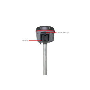
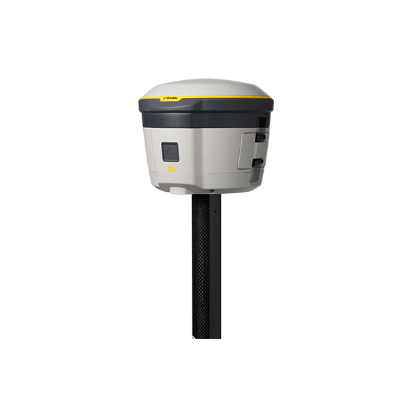
Trimble R2 Integrated GNSS System Includes: 

  • Cm accurate Trimble R2 RTK rover with GPS /GLONASS /Galileo /BeiDou, UHF 450 MHz receive radio
  • Whip antenna
  • 2 batteries (PN 92600)
  • Dual Battery Charger
  • USB cable (74408-00-SUR)
  • Quick Start Guide

Trimble GIS Data Collection

  • Easily collect data by pairing with devices such as smartphones, tablets or Trimble handhelds
  • One-button startup and compact, streamlined design enables a quick setup.
  • Flexibility to choose your data collection device.
  • Built to withstand tough conditions meeting military specifications MIL-810G for ruggedness and an IP65 rating.
  • Fast to setup, easy-to-use, keeping you productive and focused on your work.
  • Supports multiple satellite constellations and correction sources for accurate data at any location.
  • Trimble Maxwell 6 chip with 220 channels and leading GNSS technology maximizes data quality
  • A professional solution for geospatial applications ranging from sub-meter to centimeter accuracies

Max. Precision: 10 mm Horizontal / 20 mm Vertical Channels: 220 Antenna: Integrated UHF Radio: Receive RTK Compatible: Yes xFill: No Memory: 48 GB Cellular: External Satellites: GPS, GLONASS, Galileo, BeiDou, SBAS