Trimble Catalyst GNSS Systems-DA2

Trimble® Catalyst™ is a revolutionary GNSS concept delivering positioning-as-a-service to iOS and Android™ devices. With the addition of the simple, lightweight Trimble DA2 GNSS receiver and an on-demand accuracy-based subscription, turn your smartphone or tablet into a precision mapping, navigation, and measurement tool you can use with any location enabled app or service. The engine at the heart of the Catalyst positioning service is the Trimble DA2 receiver. Boasting a small size and even smaller price tag, and built using Trimble ProPoint™ GNSS technology, the DA2 delivers survey-quality RTK positioning to location-enabled Android or iOS apps. Its lightweight, compact size makes it easy to carry and stow anywhere, so the DA2 is ready to go whenever you need it.

Request Inquiry
Categories: ,

Description

Subscription-Based Positioning Solution with Trimble ProPoint GNSS Technology Delivers “Simply Precise” Mapping Workflows

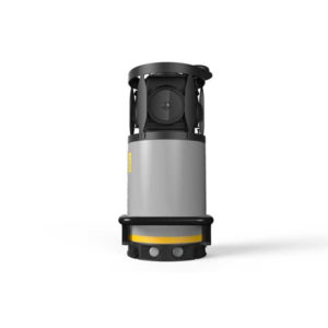
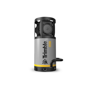
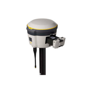
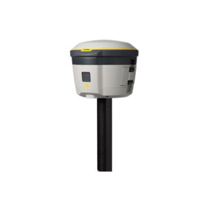
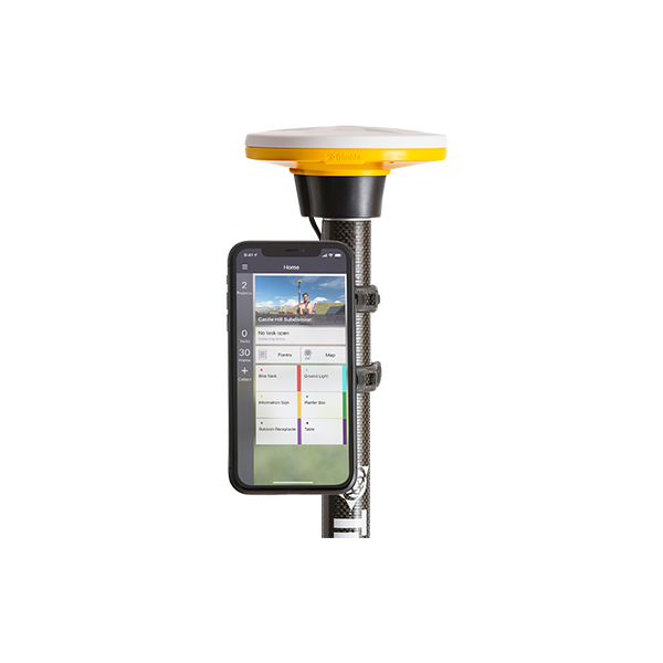
Trimble has launched the Trimble® DA2 GNSS receiver for the Trimble Catalyst™ positioning service.

“Trimble Catalyst brings easy-to-use precise positioning to location-enabled workforces,” said Gareth Gibson, marketing director, Trimble Mapping & GIS. “The addition of ProPoint technology, together with the DA2’s support for iOS devices, means Catalyst can now deliver Trimble quality positioning to more geospatial professionals than ever before.”

DA2 enhances performance with ProPoint and iOS

The DA2—the second-generation receiver and antenna for the Catalyst service—now includes the Trimble ProPoint™ GNSS engine for enhanced performance. Unique to the latest Trimble Global Navigation Satellite System (GNSS) solutions, ProPoint technology reduces convergence times and improves positioning accuracy when operating near trees and buildings.

In addition, the Bluetooth®-enabled DA2 adds iOS support to the Catalyst service, greatly increasing the range of devices, workflows and apps that can be used with the Catalyst solution.

Subscription-based GNSS positioning meets wide variety of needs

Trimble Catalyst is a subscription-based GNSS positioning service for location-enabled field applications. The service is available in accuracy-based packages from centimeter- to submeter-level for a wide range of mapping and mobile Geographic Information System (GIS) data collection projects.

Catalyst continues to support a broad range of GIS field applications, including Trimble TerraFlex™ software, for form-based GIS data collection.

Availability

Trimble Catalyst subscriptions are available now to purchase through Trimble’s Authorized Distribution Network. The Catalyst DA2 digital GNSS receiver, sold separately, is expected to be available in the fourth quarter of 2021. Trimble TerraFlex software subscriptions are available separately through Trimble Geospatial distribution partners.

Trimble Land Survey Instruments

  • Simple, precise, submeter-to-centimeter GNSS accuracy
  • Scalable and flexible accuracy-based pricing
  • Lightweight and rugged design
  • Simple installation and setup
  • Multi-frequency (L1/L2/L5/MSS) capable
  • Powered by Trimble ProPoint™ GNSS positioning technology
  • Supports all global GNSS Systems
  • Flexible mounting options
  • Connect wirelessly to iOS and Android™ devices
  • Conveniently USB powered

IN THE BOX

  • Catalyst DA2
  • 5/8″ thread mount
  • USB power cable
  • Battery clamping kit
  • Documentation

  • Type: Land
  • Year of initial introduction: 2021
  • Height [m]: 0.06
  • Depth [m]: 0.13
  • Width [m]: 0.13
  • Total Weight [kg]: 0.3
  • Housing Material: Plastic
  • Typical consumption [W]: 0.6
  • External power supply: USB
  • Operating temperature: min. [°C]: -20
  • Operating temperature: max. [°C]: 60
  • Humidity resistance: 95%, condensing
  • Water sand and dust proof: IP65
  • Shock and vibration proof: MIL-STD-810H
  • ROHS compliance: Y
  • WEEE compliance: Y
  • Tracked satellite signals: GPS (L1C/A, L2C, L5), GLONASS (L1C/A, L2C/A), Galileo (E1, E5A), BeiDou (B1, B2A), QZSS (L1C/A, L2C, L5), NavIC/IRNSS (L5), SBAS (L1C/A, L2C, L5)
  • SBAS differential signals: WAAS, EGNOS, GAGAN, MSAS, SDCM
  • RTK Network Compatibility: Yes
  • phase: RTK kinematic (constant part) [m]: 0.1
  • phase: RTK kinematic (variable part) [ppm]: 0.5
  • Bluetooth: Y
  • NMEA output format: Yes
  • other output formats: NMEA (LLH), DCOL, Android Location Service, Apple Location Service, Android Location Extras
  • L-Band Compatible: Yes