|
Survering Performance |
|
Channel |
220 Channels |
|
Signal Tracking |
BDS B1, B2, B3 |
|
|
GPS L1C/A, L1C, L2C, L2E, L5 |
|
|
GLONASS L1C/A, L1P, L2C/A, L2P, L3 |
|
|
SBAS L1C/A, L5(Just for the satellites supporting L5) |
|
|
Galileo GOIVE-A, GOIVE-B, E1, E5A, E5B |
|
GNSS features |
Positioning output rate: 1Hz~50Hz |
|
|
Initialization time: <10s |
|
|
Initialization reliability: >99.99% |
|
Positioning Precision |
|
Code differential GNSS Positioning |
Horization : ± 0.25m + 1ppm |
|
|
Vertical: ± 0.5m + 1ppm |
|
|
SBAS positioning accuracy: typically<5m 3DRMS |
|
Static GNSS Surveying |
Horization : ± 2.5 mm + 0.5 ppm |
|
|
Vertical: ± 5 mm + 0.5 ppm |
|
Real-Time Kinematic Surveying |
Horization: ± 8 mm + 1 ppm |
|
|
Vertical: ± 15 mm + 1 ppm |
|
Network RTK |
Horization: ± 8 mm + 0.5 ppm |
|
|
Vertical: ± 15 mm + 0.5 ppm |
|
RTK initialization time |
2~8s |
|
User Interaction |
|
Operating system |
Linux |
|
Buttons |
Single button operation |
|
Indicators |
Three LED indicators lights |
|
Web UI |
Freely to configure and monitor the receiver by accessing to the |
|
web server via WI-FI and USB |
|
Voice guide |
iVoice intelligent voice technology provides status and voice guide |
|
|
Supporting Chinese,English,Korean,Russian,Portuguese,Spanish, |
|
Trukish and user define |
|
Secondary development |
Providing secondary development package |
|
Hardware performance |
|
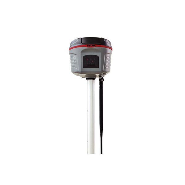
Dimension |
134×134×118 (mm) |
|
Weight |
1kg(including installed battery) |
|
Material |
Magnesium aluminum alloy shell |
|
Operating |
45℃~+60℃ |
|
Storage |
55℃~+85℃ |
|
Humidity |
100% Non-condensing |
|
Waterproof/Dustproof |
IP67 standard,protected from long time immersion to depth of 1m |
|
|
IP67 standard,fully protected against blowing dust |
|
Shock and Vibration |
Withstand 3 meters pole drop onto the cement ground naturally |
|
Power Supply |
9-25V DC, overvoltage protection |
|
Battery |
Rechargeable,removable Lithium-ion battery,7.4V; standard four batteries |
|
|
power package(optional) |
|
Battery Life |
Single battery: > 7h(static mode) |
|
|
> 5h(internal UHF base mode) |
|
|
> 6h(rover mode) |
|
Communications and Data Storage |
|
I/O Port |
5PIN LEMO external power port + RS232 |
|
|
7PIN external USB (OTG) + Ethernet |
|
|
1 radio antenna interface, SIM card solt |
|
Wireless Modem |
Built-in radio, 1W/2W/3W switchable,typical work range can be 8KM |
|
|
Raido and internet repater switchable |
|
Frequency range |
410-470MHZ |
|
Communication protocol |
Trim Talk450s,TrimMark3,PCC EOT,SOUTH |
|
Cellular Mobile Network |
WCDMA/CDMA2000/TDD-LTE/FDD-LTE 4G network modem, downward |
|
|
compatible with 3G GPRS/EDGE |
|
Double Module Bluetooth |
BLEBluetooth 4.0 standard,support for android,ios cellphone connection |
|
Bluetooth 2.1+EDR standard |
|
NFC Communication (Optional) |
Realizing close range(shorter than 10cm)automatic pair between receiver and |
|
|
controller(controller equipped NFC wireless communication module needed) |
|
External Devices |
Optional external GPRS/EDGE dual-mode communication module, switchable; |
|
|
allow to connect external WLAN card |
|
WIFI |
|
Standard |
802.11 b/g standard |
|
WIFI Hotspot |
The WIFI hotspot allows any mobile terminal to connect and access to the |
|
|
internal webserver for the control and moditor receiver |
|
WIFI data link |
To work as the datalink that receiver is able to broadcast and receive |
|
|
differential data via WIFI |
|
Data Storage/Transmission |
|
Data Storage |
8GB SSD internal storage |
|
|
Support external USB storage and automatical cycle storage |
|
|
Changeable record interval, up to 50Hz raw data download |
|
Data Transmission |
USB data transmission, supporting FTP/HTTP data download |
|
Data Format |
Differential data format: CMR+, CMRx, RTCM2.1, RTCM2.3, RTCM3.0, |
|
RTCM3.1,RTCM3.2 |
|
|
GPS output data format : NMEA 0183, PJK plane coordinates, |
|
|
Binary code, Trimble GSOF |
|
|
Network model support: VRS, FKP, MAC, fully support NTRIP protcol |
|
Inertial sensing system |
|
Tilt Survey |
Built-in tilt compensator, correcting coordinates automatically according to the |
|
|
tilt direction and angle of the centering rod |
|
Electronic bubble |
Controller software display electronic bubble, |
|
|
checking leveling status of the centering rod real time |
|
Thermometer |
Bulit-in themomter sensors, adopting intelligent temperature control technology |
|
|
which can mornitor and adjust the temperature of receiver in real time |