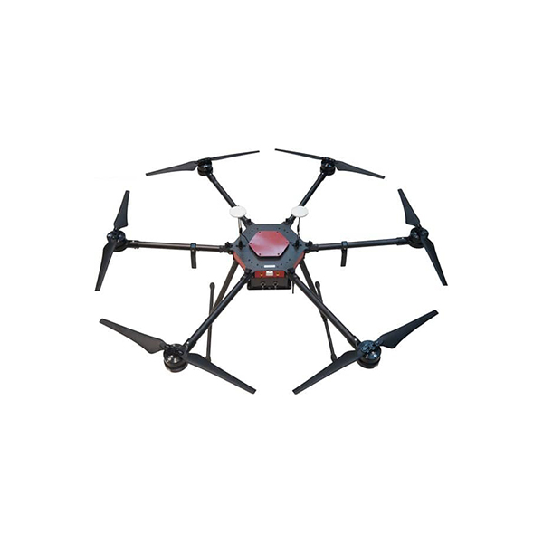
Description
SkyWalker X63 is the only model on the market with PPK/RTK upgradeability based on a multi-rotor platform while all other PPK/RTK models are just fixed-wing drones.
For the standard version, flight endurance is almost up to 1 hour, with effective aerial photography time up to 40-50 minutes, rarely multi-rotor in the market can reach so long time of endurance time.
A multifunctional drone ready for multiple payload options (integrated multi-lens camera system, infrared thermal imager, digital wireless video transmitter, airborne LiDAR system, etc.) against a variety of purposes such as mapping and other related applications.
Designed with redundancy like double flight control systems for a safer, more reliable flight experience.
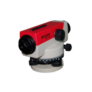
Kolida Laser Scanning Instruments
5-lens camera and 2-lens camera are designed to do projects in oblique photography, and generate 3D models of buildings or terrain models after postprocessing in photogrammetry software, such as Smart 3D, Pix4D, etc
Series: SkyWalker X63
Model: X63 (standard); X63-PPK
Aircraft Type: hexacopter, 6-rotary wings
Dimension: 121 x 121 x 40 cm
Empty weight: 4.1 kg (X63); 4.5 kg (X63-PPK)
Body Material: carbon fiber reinforced polymer
Propulsion System: electric pusher propeller
Flight Control: 3 systems available, redundancy design
Electric Motor: 6 brushless motors
Power Supply: Lithium-polymer battery, 12S, 16500mAh, 22.2V
Gimbal: slide-rail fitting
Accelerometer: 6x, for speed control
Barometer: 1x, for calculation of altitude
Magnetometer: 2x, for magnetic heading
Gyroscope: 2x, stabilizing for center of gravity shifts
GPS Receiver: 2x, for spatial positioning and waypoint navigation
GPS Tracker: 1x, for detecting the drone location in real time
PPK Receiver: SkyLines-mini, L1/L2 GNSS (GPS/Glonass/Beidou, Galileo ready)
Baud Rate: data refresh 5/20/50 Hz optional
Control Mode: remote control/auto-pilot
Operating Temperature: -20℃ ~ 50℃
Environment Humidity: 90% condensing
Radio Datalink: Frequency Hopping Spread Spectrum (FHSS)
Control Frequency: 900 MHz
Transmitting Power: 1 w
Communication Range: 5 km (normal); 10-16 km (best, upon upgrade)
Take-off & Recovery: vertical take-off and landing (VTOL)
Weather Limit: stable in winds up to 10 m/s (36 km/h), Beaufort scale 6
Hover Accuracy: H. ±1 m; V. ±0.5 m
Skyway Control: <1 m
Flight Endurance: 60 mins (w/o payload); ≥50 mins (with 5-lens camera)
Cruising Speed: 8-14 m/s
Climbing Speed: 4 m/s max.
Maximum Ceiling: 4500 m above sea level
Working Height: below 800 m