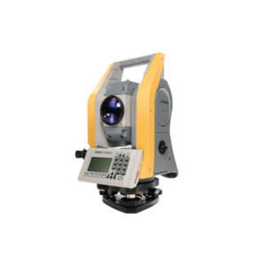
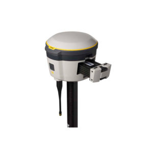
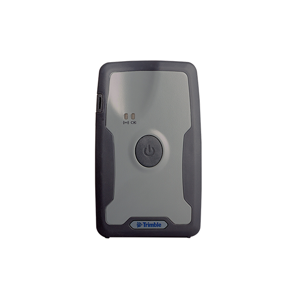
Integrated GNSS Systems-Trimble R1

The Trimble® R1 is a rugged, compact, lightweight GNSS receiver that provides professional-grade positioning
information to any connected mobile device using Bluetooth® connectivity.
Purpose-built for mapping and GIS professionals in a variety of organizations, including environmental agencies,
government departments, and utility companies, the standalone Trimble R1 receiver enables you to collect higheraccuracy location data with the device you already use—whether it is a modern smart device, such as a mobile
phone or tablet, or a traditional integrated data collection handheld or tablet.
Flexible and practical, accurate and rugged—the innovative Trimble R1 GNSS receiver delivers professionallevel positions to everyone.

Request Inquiry

Description

Improved GNSS positioning—on any device
No matter what smart device you choose—from iOS to Android—for collecting GIS data, inspecting, or
managing assets, with the Trimble R1 GNSS receiver you can achieve a greater level of reliable spatial accuracy
than your current smart phone or tablet is able to provide on its own.
• Compatible with a variety of devices to ensure your current technology investments are maximized
• Upgrade to the latest smart devices whenever needed
• Able to be shared among multiple devices

Professional data collection in more places
Capable of supporting multiple satellite constellations, including GPS, GLONASS, Galileo and BeiDou, the
Trimble R1 provides a truly global solution.
• Delivers GNSS positions in real-time without the need for postprocessing
• Correction sources such as SBAS, or VRS networks provide reliable GNSS information worldwide
• Use with Trimble ViewPoint™ RTX™ service and achieve submeter accuracy via IP with cellular
connectivity, or over satellite L-band. The ViewPoint RTX correction service is available on the
Positioning Services store: https://tpsstore.trimble.com

Built to work the way you do
• Rugged, lightweight, and compact, the Trimble R1 GNSS receiver can go wherever you go.
• Weighs just 187 g and measures 11.2 cm x 6.8 cm x 2.7 cm
• Cable-free operation with Bluetooth® connectivity
• Can be pole-mounted, carried in a vest pocket, or attached to a belt using the optional belt pouch for ease
of use
• All-day battery life gives you a full day in the field
• Built to last with certified MIL-STD-810 ruggedness with IP65 rating

GNSS Receiver
• L1/G1
o GPS, GLONASS, Galileo, Beidou, QZSS
o 44-channels, parallel tracking
• Higher accuracy
o Autonomous positioning
o Augmentation
o Corrections

Augmentation
• WAAS, EGNOS, MSAS, GAGAN
• 4-channel, parallel tracking

Trimble GIS Data Collection

The Trimble® R1 is a rugged, compact, lightweight GNSS receiver that provides professional-grade positioning information to any connected mobile device using Bluetooth® connectivity.

  • Small, rugged, lightweight GNSS receiver for great mobility
  • Compact, cable-free solution with integrated antenna
  • Flexibility to choose your data collection device
  • Bluetooth connection to Trimble handhelds or consumer-grade smart devices
  • Provides higher-accuracy location data
  • Flexible, professional data collection in more places
  • Optional ViewPoint RTX provides submeter accuracy via IP or satellite

Delivering professional-level positions to everyone

  • Purpose-built for mapping and GIS users in a variety of organizations, including environmental agencies, government departments, and utility companies.
  • Enables you to collect higher-accuracy location data with the device you already use—whether it's a modern smart device, such as a mobile phone or tablet, or a traditional integrated data collection handheld or tablet.
  • Achieve a greater level of reliable spatial accuracy than your current smart phone or tablet is able to provide on its own.
  • Compatible with a variety of devices to ensure your current technology investments are maximized
  • Upgrade to the latest smart devices whenever needed.
  • Able to be shared among multiple devices.

Professional data collection in more places

  • Capable of supporting multiple satellite constellations, including GPS, GLONASS, Galileo and BeiDou for a truly global solution.
  • Delivers GNSS positions in real-time without the need for post-processing.
  • Correction sources such as SBAS, VRS, or RTX networks provide reliable GNSS information worldwide.
  • Use with the optional Trimble ViewPoint™ RTX™ service* and achieve submeter accuracy via IP with cellular connectivity, or over satellite L-band.
  • Works with Trimble and third-party software.

​Built to work the way you do

  • Rugged, lightweight, and compact, the Trimble R1 can go wherever you go.
  • Weighs just 187 g and measures 11.2 cm x 6.8 cm x 2.7 cm.
  • Cable-free operation with Bluetooth® connectivity.
  • Can be pole-mounted, carried in a vest pocket, or attached to a belt using the optional belt pouch for ease of use.
  • All-day battery life gives you a full day in the field.
  • Built to last with certified MIL-STD-810 ruggedness with IP65 rating.