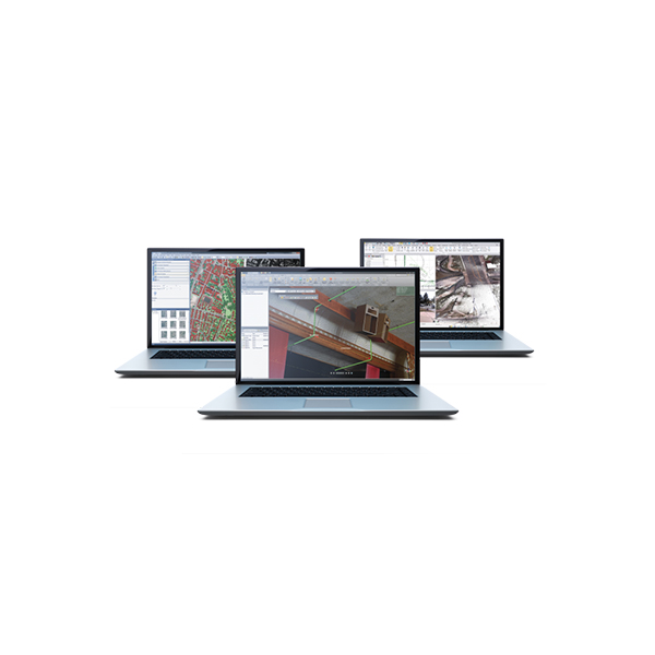
Description
SURVEY + CONSTRUCTION FIELD TO FINISH WORKFLOWS WITH CONFIDENCE
Leverage the power of raw geospatial and construction data in a single, robust software environment to confidently deliver project
after project with Trimble® Business Center (TBC) office software. Using streamlined, yet powerful, workflows designed for surveyors
by surveyors, take your survey and construction data further with powerful TBC tools when working with CAD, surfaces, corridors, point
clouds, photogrammetry, and more. With your professional reputation, financial well-being, and requirements on the line, use TBC’s unique
capabilities to stand out from your competition and deliver superior results to your clients.
Data Integration
In a single software package, combine raw measurements from GNSS, total stations, and levels — then, add in data from unmanned aerial
vehicles (UAVs), mobile mapping systems, and terrestrial laser scanners— all of which is scaled to your survey data. No need to import and
export between multiple software packages. No need for training, renewals, or support for different applications from different providers.
TBC provides the capabilities you need to deliver complete survey and construction deliverables.
Confidence Inspiring Results
Work with raw sensor data, not just X,Y,Z coordinates, view and edit rod heights, prism constants, vector timestamps, and more to achieve
the most accurate horizontal and vertical results. Visualize your data in context with Google Earth or import background maps and imagery.
Don’t put up with fragmented data sets or disjointed workflows that cause costly mistakes and jeopardize your deliverables. Easily back
up office and field data imported from Trimble and other third-party hardware, ensuring complete traceability throughout your project.
Robust Deliverables
When “good enough” is not acceptable, TBC ensures your ability to deliver the highest quality results, which can be displayed in a large
variety of reports and spreadsheets, digital surface and site models, CAD plans, point clouds, aerial ortho photos, corridor and tunnel
designs and as-builts, machine control models, station-based images, and much more. Easily work with other industry-leading software
packages such as Autodesk® , Bentley® , and ESRI with powerful import and export support for a variety of third-party file types. Store and
share projects online using Trimble Connect, Trimble Sync Manager™, Trimble Clarity™ , Google Earth™ , and Bentley ProjectWise®.
Trimble Office Software
Field Data QA/QC
Import and interact with Trimble and third-party raw data.
► Visualize, interact, and measure your data across multiple views and reports.
► Check and edit raw data with spreadsheets, selection filters, and interactive property menus.
► Sync data with Trimble Access, SCS900, and machine control systems.
► Process feature codes from the field or keyed into TBC.
► Provide context with background maps, georeferenced images, and overlays in Google Earth.
Adjustment and COGO
Efficiently reduce observations and perform cadastral survey workflows.
► Process static and kinematic GNSS observations and export GNSS vectors in National Geodetic Survey (NGS) *.gvx files consistent with varying thirdparty manufacturer hardware.
► Compute and adjust traverse and level runs.
► Translate field book data and notes into the Level Editor and Total Station Editor.
► Complete least square corrections with mixed data observations and constraints in the Network Adjustment.
► Input survey plans, compose legal descriptions, and compute parcel misclosures intuitively with the Create COGO routine.
CAD and Drafting
Produce your final survey linework, construction models, and roadway design plots with ease.
► Quickly draft and edit points, 2D or 3D linework, and CAD geometry with the keystroke-based CAD Command Line.
► Use Dynaviews to place your model space data into sheet plots.
► Add dynamic labels, line and curve tables, scale bars, and other map elements.
► Automatically plot profiles and cross-sections for alignment-based surfaces or corridors.
► Create digital deliverables such as *.dwg CAD files or print deliverables like plan sets or 3D PDFs for communication and collaboration.
Surfaces and Volumes
Create, process, and deliver complex surface models for field devices, machine control systems, and third-party export.
► Create traditional, projected/vertical, and radial surfaces that dynamically update when surface members are modified.
► Generate quick and accurate volume reports from surface comparisons, stockpile/depression, and corridor surfaces.
► Compute gridded Cut/Fill surfaces and reports with customizable color mapping.
► Specify contour lines and labels that update as a reference surface changes.
► Drape objects onto surface and run point-to-surface comparisons.
Takeoff and Mass Haul
Calculate earthwork and material quantities of a construction project.
► Define site improvements in the Material Site Manager for computations and reports.
► Generate takeoff reports for earthwork, materials, and costs.
► Balance and optimize earthwork volumes to reduce borrow and waster.
► Plan and design optimal material haul routes.
► Create mass haul diagrams and reports to plan and monitor progress for sites and corridors.
Alignments and Corridors
Model and manipulate alignments and parametrically-designed corridors.
► Define horizontal and vertical alignments from scratch or existing CAD linework with support for station equations and superelevations.
► Enter corridor template instructions with interactive, graphical feedback.
► Handle complex roadway designs with conditional instructions and slope and node tables.
► Design corridor features such as interchanges, ramps, and intersections with parameter prompts.
► Generate corridor earthwork reports, apply material properties, and create subgrade surfaces.
Trimble VISION and Aerial Photogrammetry
Adjust, measure, and model from Trimble VISION™ technology and leading UAV providers like DJI, senseFly, Wingtra, Delair, and more.
► Extract points and geometry from station imagery, ortho images, and point cloud data using a variety of matching techniques.
► Generate photo tie-points automatically and match ground control points (GCPs).
► Create high-resolution point clouds, orthomosaics, and elevation raster digital surface models (DSMs) from Trimble or third-party UAVs.
► Use Inpho UASMaster for additional processing, deliverables creation, and QA/QC options.
► To learn more, see the TBC for Aerial Photogrammetry and LiDAR Technical Notes.
Data Prep
Make sure your data is clean, up-to-date, and delivered in the right format to get the job done.
► Import, clean up, and organize CAD and *.pdf data with Project Cleanup and import work orders from WorksManager.
► Extract and digitize data from vector PDFs.
► Elevate 2D contours, points, lines, and polygons into 3D models with parametric side slope and vertical design tools.
► Interact with site and corridor designs from third-party packages with support for a variety of CAD and BIM formats.
► Create linework, surfaces, and avoidance zones for machine control systems.
Scanning and Point Clouds
View, manipulate, and extract information from terrestrial, mobile, and aerial point cloud data.
► Colorize, register, georeference, and adjust Trimble SX-series, Trimble TXseries, Trimble X7, and third-party scan data.
► Scale scan and point cloud data to survey data in an integrated project environment.
► Compare as-built reference point cloud regions to BIM objects, tunnel design meshes, surfaces, or other point cloud regions to create heat maps.
► Classify regions, segment point clouds, and use limit boxes to manipulate scan data from formats like *.las, *.pts, *.e57, and more.
► Extract point, line, and cross-section features using user-defined planes and automatic and semi-automatic feature extraction tools.
GIS
Integrate GIS within survey data and provide deliverables to an ESRI-based environment.
► Extract schemas and convert from GIS sources with the same symbology to feature definition code libraries (*.fxl).
► Connect to different GIS data sources, including File Geodatabase, Shapefile, and Enterprise Geodatabase. (Support for ArcGIS Pro is now included!)
► Post-process *.ssf GNSS data from TerraFlex™ and other Trimble GIS field sources.
► Map metadata from data source connections.
► Import and process *.cor files with feature and attribute data from Trimble GPS Pathfinder® Office (PFO).
Utility Modeling
Define gravity or pressure-based utility networks for takeoff and visualization applications.
► Create pipe and utility networks.
► Customize utility shapes and structures.
► Design parametric trench templates and surfaces.
► Add utility models to existing sitework, CAD geometry, and surface context.
► Generate customized utility takeoff reports.
Tunneling
Work with Trimble Access Tunnels and leverage TBC’s point cloud and reporting tools for tunnel survey workflows and deliverables.
► Parametrically design tunnel shape templates with dynamic cross-section interface.
► Intuitively design set-out positions like blast holes, rock bolts, and more for infield stake out via Trimble Access Tunnels.
► Analyze designed or as-built tunnel meshes to produce customized heat map comparisons and assign as-built points from point cloud data to create 3D as-built inspections.
► Generate comprehensive as-built reports to convey overbreak/underbreak estimates, as-built center points, and more.
► Perform as-built to design and as-built to as-built inspection using total station or point cloud data to verify shotcrete thickness, excavation shape, and final lining position.
Monitoring
Utilize survey data collected using Trimble Access Monitoring or thirdparty field software to generate periodic or campaign-based monitoring deliverables.
► Manage monitoring data utilizing tools for editing, deleting, and adding epochs from all survey data — total station, GNSS, level, or point cloud.
► Automatically process and report on multiple epochs using data contained in *.json files imported from the Trimble Access Monitoring application.
► Define warning and alarm thresholds to flag points with significant movement.
► Visualize movement patterns and magnitude using 3D displacement vectors and interactive charts showing movement level thresholds.
► Customize and create comprehensive monitoring reports showing displacements in various formats for client requirements.
Mobile Mapping
Import and process data from Trimble’s mobile mapping hardware platforms like the MX7, MX9, and MX50.
► Adjust, colorize, and register scan data with single run or multi-run options and precise target-picking tools.
► Calibrate scanner and camera alignments for the MX9 and MX50 mobile mapping systems.
► View mobile mapping runs, GNSS/IMU trajectories, and imagery.
► Post-process raw trajectory data against local base stations or CORS networks.
► Export data to third-party and Trimble software such as TMX, Mapillary, TopoDOT, Solv3D, and Horus. To learn more, see the TBC for Mobile Mapping Technical Notes.
Drilling, Piling, and Dynamic Compaction
Prepare work plans and connect to DPS900 systems.
► Create boring and drilling plans and work reports.
► Create foundation and infastructure piling plans and work reports.
► Create dynamic compaction plans and work reports.
► Customize pile types and drill quality reports.
► Import and export to Trimble DPS900 systems.